Tag Archives: Vik

Day 5 – Seyðisfjörður

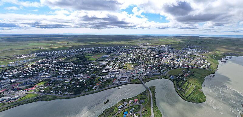
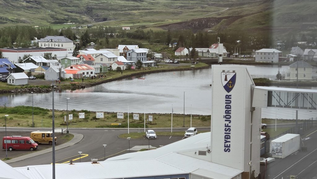
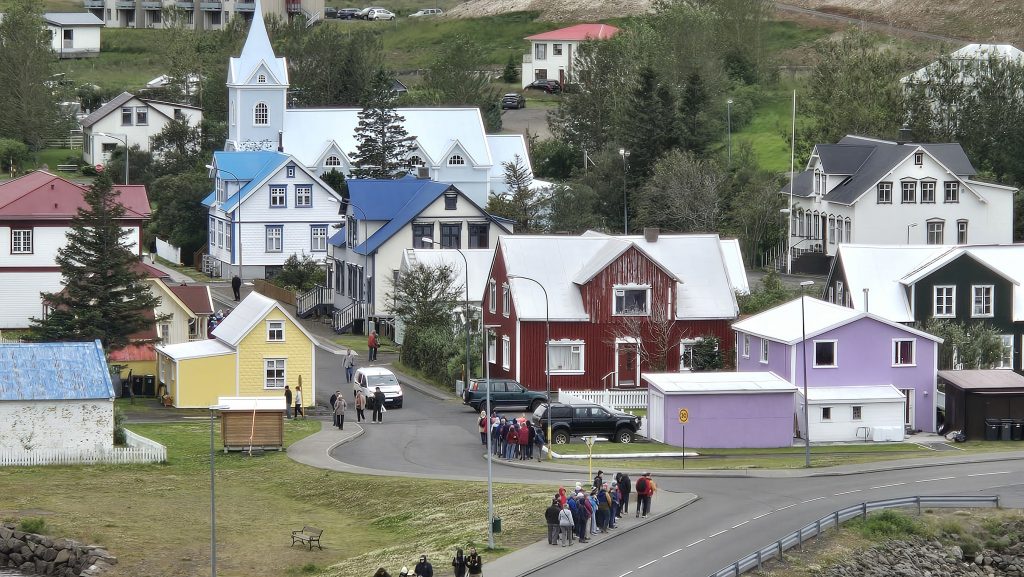
I was really looking forward to Seyðisfjörður (“say-this-fyor-thur”), a town in eastern Iceland, sitting at the innermost point of the fjord of the same name. We had turned to streaming services during COVID and discovered Ófærð (Trapped), an Icelandic crime series which was filmed in Siglufjörður in the north and Seyðisfjörður in the east (even though the two towns are four and a half hours apart on the Ring Road and that’s when the weather is good.) The ship passed Siglufjörður during the night on our way to Akureyri, so this would be my only chance to see where part of the series was filmed.

Trapped was our introduction to Nordic Noir – crime fiction that is deeply dark, brooding, and often brutal, unlike the often-stereotypical image of blonde, cheery Scandinavians frolicking in fields under the midnight sun. It is the antithesis of the popular British “cozy murder mystery” like Midsomer Murders, Father Brown, anything Agatha Christie and Grantchester. Henning Mankell is considered to be the father of Nordic Noir with his Kurt Wallander books. Other noted authors are Sweden’s Steig Larsson (The Girl With the Dragon Tattoo), Iceland’s Arnaldur Indriðason (Detective Erlendur), Norway’s Jo Nesbø (Detective Harry Hole). and Finland’s Leena Lehtolainen (Detective Maria Kallio).

In the first season of Trapped, Andre Olofsson, the police chief of an isolated town in Iceland, tries to unravel the murder of a man whose frozen torso is discovered in the harbor, while also dealing with his dysfunctional marriage. (Ólafur Darri Ólafsson, who bears a striking resemblance to our nephew Christopher, plays Andre) We saw it on Amazon Prime, but as of this writing it has moved to Plex, Pluto TV, and The Roku Channel. Watch the trailer here.

But I digress…

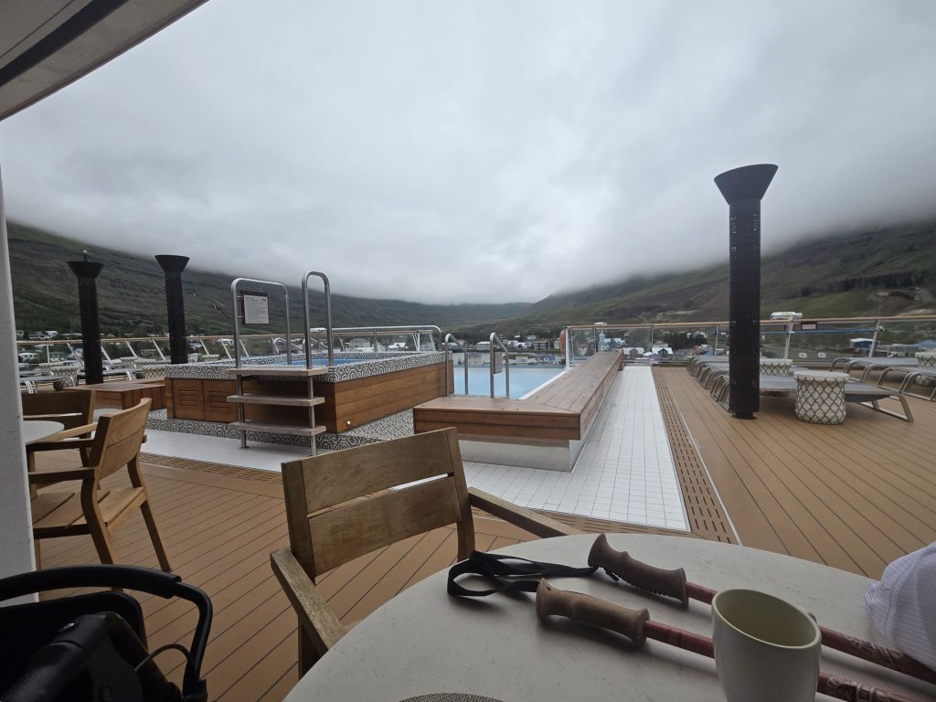
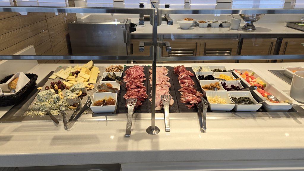
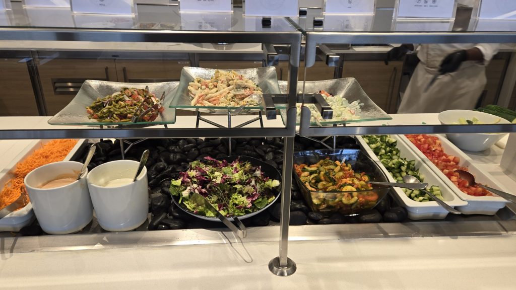
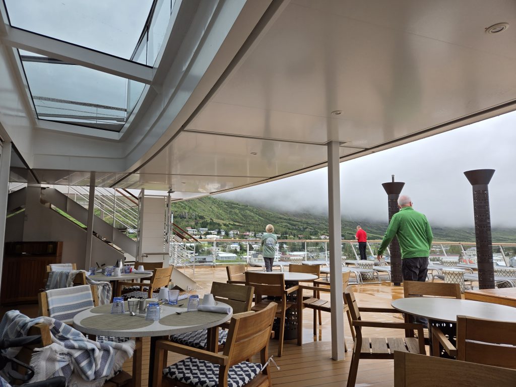
We hadn’t ordered room service for breakfast, so we had to get food in the World Café, a big mistake!  There were no inside tables at 9a.m., so we filled our plates and went out to the deck, which was really cold. We lasted about 10 minutes before hustling back to the ship’s warmth.

Cloudy and about 50°

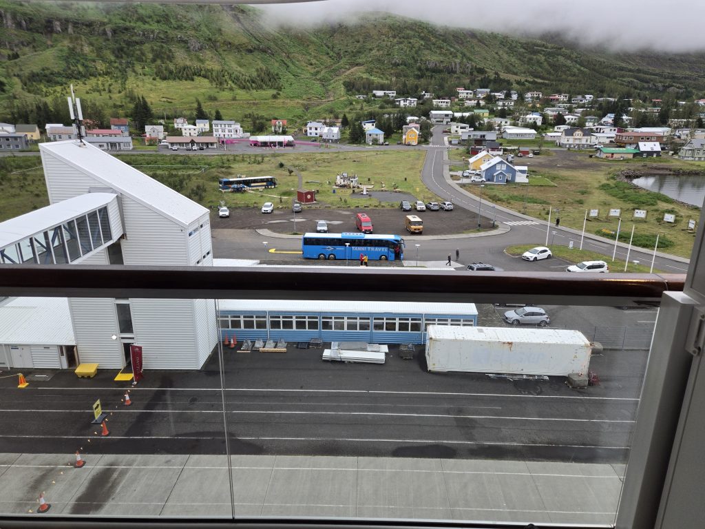
We didn’t get a chance to visit any of the area’s highlights. Our previous excursions combined with the cold, damp weather left us tired and uncomfortable, and we didn’t book one of the bus tours. I had planned on the walking tour of Seyðisfjörður but only got as far as the port terminal before realizing it would not be a great idea. I bought a 2000 ISK (~ $14 US) potholder in the terminal with a 10,000 ISK bill (~ $72 US) just to get smaller denominations for tips and small purchases.

History of Seyðisfjörður
According to Landnámabók, the Icelandic Book of Settlement, Bjólfur (“Byol-foor”), blood brother of the powerful sorcerer Loðmundur the Old, settled in the fjord in the 11th century. There are graves dating back to the 8th century in the area around Seyðisfjörður. The town sits at the base of the mountain named after him, and Bjólfur is thought to be buried near the peak. Esja Architecture designed the Ring of Bjólfur a cantilevered 360° viewing platform, 650m/2133 ft. above the town, which is scheduled to be completed in 2025.

Seyðisfjörður began to develop in 1848 when Norwegian fishermen established the area as a fishing and trading post. There was a modern whaling station in nearby, now abandoned, Vestdalseyri (“Vest-dal-say-ree”)  between 1864 and 1866. In 1906 the first telegraph cable from Europe to Iceland terminated in Seyðisfjörður. A dam created across a nearby river was used to create the first hydroelectric plant in Iceland in 1913, supplying electricity to homes and street lights.

Although neutral and united with Denmark, the British Royal Navy and Royal Marines preemptively invaded and occupied Iceland in 1940. The Germans sank the British oil tanker El Grillo (The Cricket) sitting in Seyðisfjörður’s port, on February 11, 1944. The Kaffi Lára El Grillo Bar (named after the El Grillo and the previous occupant, the “legendary” Lára) serves meat, fish and a wide variety of Icelandic beers.

In December 2020 heavy rain triggered a series of mudslides which destroyed twelve houses, damaged more than forty others and the Technical Museum of Iceland. Seyðisfjörður was evacuated and the residents didn’t return until October 2021.

Seyðisfjörður has relied heavily on tourism, even more after Brim Seafood Company’s  local, outdated fish-processing plant shut down in 2023.  

The Smyril Line’s ferry Norröna, registered in the Faroe Islands, sails between Seyðisfjörður, the Faroe Islands and Hirtshals, Denmark mid-March through late November.  The terminal is an international port, so one must show a passport when going through the building in either direction, even though our ship was docked there. (The ferry was central to Trapped Season One’s plot.)

Seyðisfjörður International Port

The Road not Traveled
I did some research for this post about the opportunities we missed.

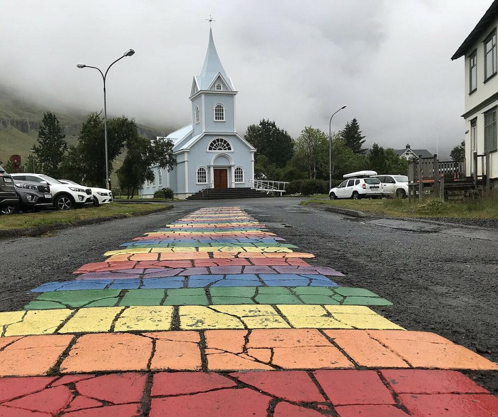
Seyðisfjarðarkirkja (“say-this-fyar-thar-kir-kya””), the iconic Blue Church, is one of the most famous sights in Seyðisfjörður, sitting at one end of Norðurgata (“North-ur-ga-ta”), the Rainbow Walk.

Walking tour with the Blue Church in the background.
Seyðisfjarðarkirkja and the Rainbow Walk

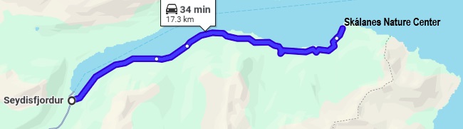
Skálanes (“Skau-la-nes”) Nature and Heritage Center sits on 1250-hectares/3100-acres about 17.4km/11mi northeast of Seyðisfjörður. More than forty bird species make their homes in the cliffs along the coast. Arctic terns and eider ducks have the largest colonies in the area. The ducks shed down from their breasts to keep their eggs warm. Eider down is an excellent insulator and harvesting the down is an Icelandic tradition. People use hay or seaweed to replace the down.

Seyðisfjörður has become a cultural center for artistic creativity. The Skaftfell Center for Visual Art was founded in honor of Dieter Roth, an influential Swiss-German artist who lived here in his later years. The Center supports established and ascending artists with a residency program, hosting exhibitions and seminars. The Skaftfell Bistro, on the Center’s ground floor,  is said to be one of the best places to eat in Seydisfjordur,

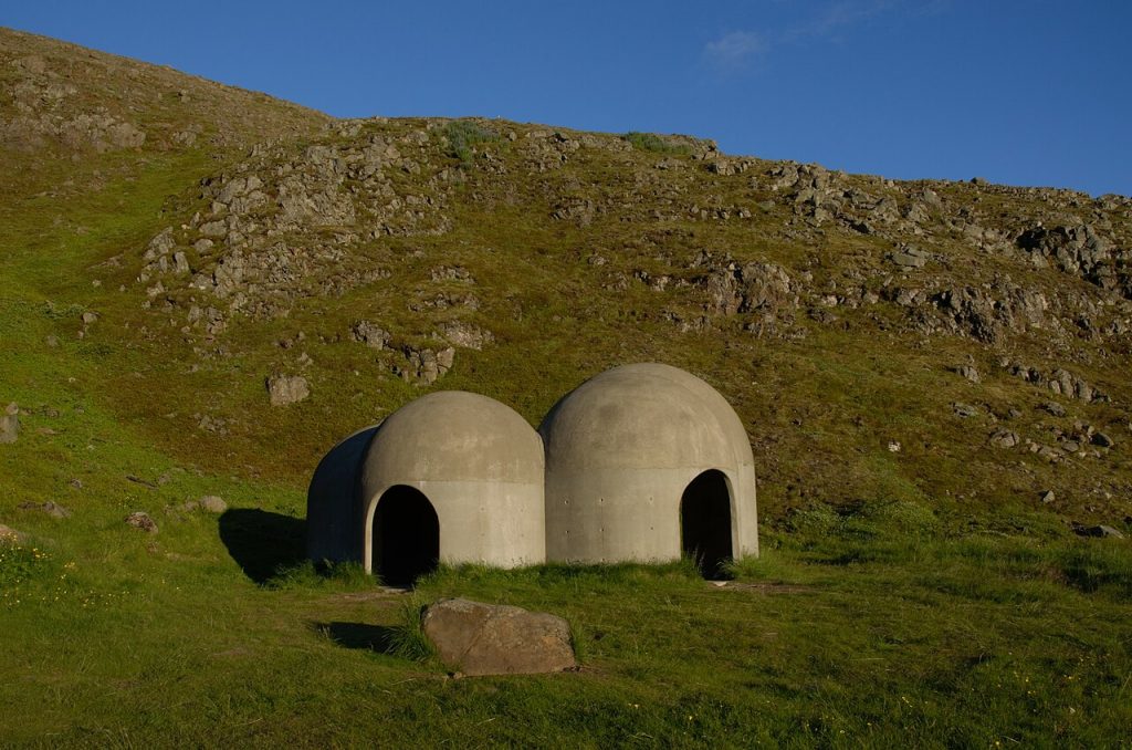
One of the more intriguing parts of Skaftfell is Tvísöngur (“Tvis-on-gur”), which means “two songs” in Icelandic. Lukas Kühne, a German-born artist, created Tvísöngur, a “site specific sound sculpture” of five interconnected domes of varying dimensions, designed to resonate to specific tones. I don’t understand the physics, but if you are morbidly curious, here’s a link to an academic thesis: Lukas Kühne’s Tvísöngur: Sculpture for a Concrete, Uncompressed Voice

Tvísöngur

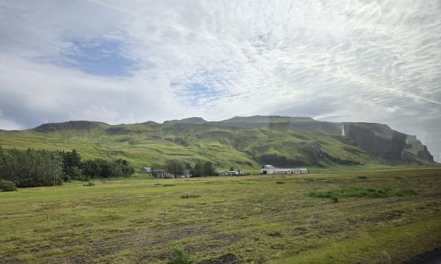
Fjarðarheiði (“Fyar-thar-hay-thi”) is a 24.5km/15.22mi long mountain pass between Seyðisfjörður and Egilsstaðir (“Ae-yil-sta-thir”). The drive takes one from lush countryside to barren tundra at the 623m/2,043ft peak. It is a rather scenic drive if one is blessed with good weather. (We would likely have driven through fog if we’d made the trip). The Fjarðará River (“Fyar-tha-ra”) runs west along the roadway from Seyðisfjörður and is a good place for flyfishing in the summer. During the winter one can ski at Stafdalur Ski Station, (“Staff-da-lure”) a short 7.8km/4.8mi from Seyðisfjörður.

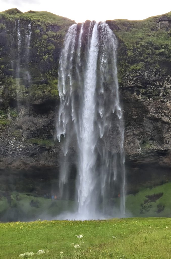
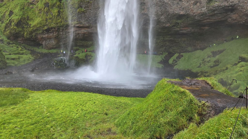
There are several waterfalls between in the area, the largest one being Gufufoss (“Goo-fu-foss”) about 4km/2.5mi southwest of Seyðisfjörður. Gufufoss means “steam waterfall” in Icelandic, so named because of the heavy mists that rise from the base of the falls. Gljúfurfoss (“Glue-fur-foss”), one of two falls with the same name is 5.1km/3mi west of Gufufoss, just east of Lake Heiðarvatn (“Hay-thar-vat”), and not to be confused with the other Lake Heiðarvatn, north of Vik in Southern Iceland.

Fardagafoss (“Far-da-ga-foss”) is 5.4km/3.5mi east of Egilsstaðir, at the roots of Fjarðarheiði. Ancient folklore told of a giant female troll with a large cauldron filled with gold who lived in the now-collapsed lava cave behind the falls. Sensing her coming demise, she pushed the kettle into a deep hole in another, different, falls named Gufufoss. Legend says you can see the kettle’s handle when the water level drops. One can also explore the Fardagafoss Hiking Trail.

Read more: What to do in Seyðisfjörður | The Charming Village in East Iceland

We opted to have lunch again at the Pool Grill, then headed back to our room. Peg spent the afternoon reading and I decided to go back to the Nordic Spa and the timing couldn’t have been better. The first time I saw the spa was early evening, just before dinner and the pool looked like old people soup. This time there was no one in the hot tub, so I tossed my towel and robe on one of the loungers and simmered for about fifteen minutes. From there I went to the steam room, then the snow room. There was still no snow, just the pile of slush in the corner.

Afternoon Tea
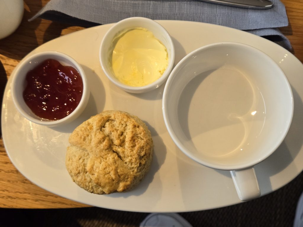
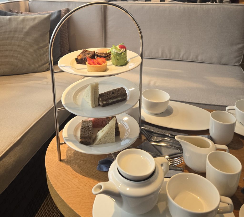
Back from the spa, Peg suggested we attend the daily “afternoon tea” in the lanai off the pool deck.  A British tradition, afternoon tea was traditionally held around 4pm, when the idle rich indulged in finger sandwiches, scones and pastries along with their tea. High tea was a hardier meal the working class consumed after work. (Remember Roger Daltry in a tub of Heinz Baked Beans: “What’s for tea?”)

We sat on comfortable, low-backed seats with a grand view of the harbor and grey skies. One of the waitstaff brough a plate of scones followed by a three-tiered tray of finger sandwiches and pastries. Peg ordered a pot of tea, and I decided to try out a shot of Linie (“Lee-nee”) a Norwegian aquavit made from potato, flavored with caraway dill, fennel, anise and coriander. It is then matured at sea, in Oloroso sherry casks, during a round-trip voyage between Norway and Australia while crossing the “LINE” (equator) twice. It was…interesting, not as vile as Malört. I thought I’d avail myself of Iceland’s Black Death (Brennivin) before we left.

The remainder of the trip was disappointing; I’ll address that in the next post

Photo Credits
Featured image: Seyðisfjörður town view, Kasa Fue September 2019, 10:19:01. Licensed under the Creative Commons Attribution-Share Alike 4.0 International license.
Seyðisfjarðarkirkja and the Rainbow Walk Saifunny 26 July 2018. Licensed under Creative Commons Attribution-Share Alike 4.0 International 
Tvísöngur, listaverk eftir Lukas Kühne frá árinu 2012, staðsett á Seyðisfirði. Cinquantecinq  6 July 2020. Licensed under Creative Commons Attribution-Share Alike 4.0 International 
All other photos mine

Day 2 – The Southern Coast of Iceland Tour

We had signed up for the “Panoramic Southern Coast of Iceland” bus tour, partly because the activity level was described as “easy,” but that was a big mistake. It turned into nine exhausting hours of getting on and off a bus, hiking across rocky paths (which limited Peg’s exploring), and enduring an obnoxious, older (60s) but completely able-bodied couple who defiantly were the last to get back on at each stop, despite our guide’s repeated warning, “We are on a tight schedule.”

The tour bus left at 7:30am; it’s a good thing we had gone to bed early and had adjusted to the time difference. Room service arrived at 6:30am; I grabbed one of the bathrobes to avoid opening the door stark naked. We had a delicious light breakfast, then grabbed our jackets, the QuietVox modules, and Peg’s Rollator, and headed for the elevator. We scanned our room cards at the ship’s exit point, walked down the ramp and through the terminal checkpoint, and then stood in line outside waiting for our bus. Getting off the ship was much easier this time as we were at low tide, and the ramp wasn’t as steep.

Our bus was the third in line, and we were afraid we’d have to walk to it, but the first two buses departed and ours took their places. The bus driver loaded Peg’s rollator under the bus and our tour guide took our tour passes and welcomed us on board. We headed for a pair of seats in the middle of the bus. Before we left our tour guide had us turn our QuietVox sets to Channel 3 and made sure we could hear her through the headphones. (One of the tourists later deduced the channel always corresponded to the bus number.)

One might be forgiven for expecting the bus to have nice, comfy wide seats with generous leg room as seen in movies. Our seats were closely spaced, firm and built for skinny Europeans instead of fat American asses-worse than airline steerage class. The seatbelts were barely long enough and trapped us in uncomfortable positions. After the first rest stop, we moved to the five seats along the back and had much more room.

It was overcast and drizzly as we headed south from the terminal to Route 49, then east to Route 1, known as the Ring Road because it circles the entire island. After several minutes the outskirts of Reykjavik disappeared, and we were in the rugged countryside. Our guide pointed out steam coming from thermal vents near the road.

A thermal vent by Route 1

Geothermal energy provides Iceland with about twenty seven percent of its electrical power; hydroelectric power makes up the rest. Superheated, acidic steam collected from deep wells powers electrical turbines. Heat exchanges warm the water that is used to heat about 86% of Iceland’s homes and businesses. And geothermal water provides Iceland with its famous spas. (The Blue Lagoon isn’t a natural formation; it was created when the Svartsengi Power Station released geothermal brine was released into the lava field.) The guide at our last stop, the Lava Centre, told the group that his monthly electric bill is about eight bucks because electricity is so cheap.

Unveiling the Secrets of Iceland’s Geothermal Energy

We passed an airfield marker which seemed completely out of place as there were no visible hangers or aircraft. I discovered this is the Sandskeið glider port; here’s a video of a glider in flight. (Seriously, someone tell me when Iceland has sunny days, because it never looked like this during our trip!)

Hveragerði
The mist turned into fog as we gained a few hundred feet in altitude, then dissipated as the highway descended towards Hveragerði (pronounced: KVER-ah-ger-thhi). An earthquake in 2008 devastated much of Hveragerði; when the town rebuilt, it expanded its greenhouse industry, becoming Iceland’s “greenhouse capital,” providing the island with fresh produce year round, including tomatoes, cucumbers, strawberries, lettuce, red and green peppers, mushrooms, herbs and cut flowers. Carrots and potatoes grow outside in geothermically warmed soil. One can tour the Friðheimar family farm, learn about greenhouse production, enjoy fresh tomato soup, fresh tomatoes with Burrata cheese, and visit Icelandic horses in the farm’s stables. (Do not, under any circumstances, refer to them as “ponies!)

Selfoss
We crossed the Ölfusá river into Selfoss, a commuter town about 30 miles from Reykjavik. Selfoss means “Seal Falls” in English, but there are no seals and no waterfalls. It’s a pity we didn’t stop here because the town has a lot to offer. Having also suffered significant damage from the 2008 earthquake, Selfoss rebuilt a New Downtown, a vibrant, pedestrian-friendly area with shops, restaurants, and recreations of buildings from Iceland’s past, like the Old Dairy Food Hall. Skyr, the thousand-year-old Icelandic yogurt, is mostly made in Selfoss. The Bobby Fischer Center houses memorabilia of 1972 chess champion, who lived in Selfoss from 2004 until his death in 2008.

Aerial View of Selfoss

Hvolsvöllur
From Selfoss we headed east, stopping in Hvolsvöllur (pronounced “Kvols-vol-yur”) for a bathroom break at the N1 fuel and charging station’s Nesti grill. The bathrooms are exceptionally clean, and the staff is very friendly. I bought a couple of water bottles and some chocolate. We would stop at the Lava Centre here on our way back, but it would have made more sense to do it first, since we were exhausted by that time. We continued on to Seljalandsfoss Waterfall.

Sheep May Safely Graze
We saw sheep grazing along the highway, sometimes on the wrong side of the fence. There are an estimated 500,000 to 800,000 sheep in Iceland, outnumbering the human population. Icelandic sheep were susceptible to diseases introduced by selective breeding in the 19th century so now importing sheep is illegal. The subsequent isolation produced a very pure strain, and Icelandic wool is unique-and scratchy!  Peg’s hand became very irritated after feeling a sweater in one of the gift shops.

Sheep breeding begins in November; they give birth in May, a time known as Sauðburður. Then all the sheep are turned loose across the countryside for the summer. Free-range grazing is much cheaper than buying feed and, if a few of them are lost falling off a cliff or being hit by a car (sheep are apparently not very bright), it isn’t a big loss. Lamb is one of the main animal proteins in the Icelandic diet (the other is fish), and most lambs go to slaughter when they are 4-5 months old, undoubtedly disturbing the increasing numbers of vegans in the country.

Smölun, the annual sheep gathering begins in September. Farmers, their families and friends gather to herd the estimated 380,000 sheep into Réttir, large pens where they are sorted by earmarks, then sent back to the farms for the long, cold Icelandic winter. The roundup concludes with Réttarball, a celebration with live music and considerable amounts of alcohol.

Sightseeing by bus can be rather disappointing. You get off the bus, wander around the site for fifteen to twenty-five minutes, maybe relieve yourself or buy tchotchkes at the requisite gift shop, before being herded back onto the bus like cattle. It seems none of the tourist attraction parking lots are paved; they are covered with pieces of black rock which makes ambulating difficult for those with walker, canes or poor balance. Peg stayed on the bus during many of our subsequent stops.

Seljalandsfoss
Seljalandsfoss (pronounced “selya-lands-foss”) is fed by melting water from the nearby Eyjafjallajökull (pronounced “ay·uh·fyaat·laa·yow·kl”) glacier which covers the volcano that erupted in 2010, disrupting air travel in across Northern and Western Europe. The water plunges almost 200 feet to the meadow below. If one is in good physical shape, there is a foot path from the parking lot that winds around the back of the falls, providing a spectacular view and a good soaking. (One foresighted couple brought light rain pants.)  I made it part of the way up the hill, took a few pictures and went back to Peg, who was waiting on a bench next to the parking lot.

Seljalandsfoss Waterfall
The stairs leading to the path behind the waterfall

Reynisfjara
We continued on to Reynisfjara Black Sand Beach, (pronounced “ray-nis-fyah-ra”) about 36 miles farther east, which lies at the base of Mt. Reynisfjall.  Reynisdrangar, large basalt columns, lie just off the beach shore and were used in Game of Thrones Season 7. According to legend, they were formed when two trolls tried to grab a passing ship, but when the sun rose, they turned to stone. Another legend says two different trolls murdered a woman; her husband found them, dragged them into the sunlight and turned them to stone.

One of the offshore basalt columns

The beach can be dangerous. Visitors have lost their lives when large “sneaker” waves, up to 120 feet tall, suddenly appear and pull anyone too close into the ocean. Our guide warned everyone to stay well away from the water’s edge, but predictably some people threw caution to the wind.

Vik
Vík í Mýrdal, Vik for short, is a small village 3 miles east of the beach as the crow flies, but 7 miles by road. It lies directly south of the Mýrdalsjökull (pronounced “myir-tals-yo-kʏt”) glacier which covers the Katla volcano, which last erupted in 1918. Residents know they have only 15 minutes to evacuate if there is another eruption, as melting glacier water would quickly obliterate the town.

Mýrdalsjökull

The 2010 Eyjafjallajökull eruption covered Vi kin ash. In 2021 Icelandic director Baltasar Kormákur and writer/producer Sigurjón Kjartansson created KATLA, a mystery-drama television series for Netflix. The plot: a year after Katla erupts, people thought to be dead or missing begin to reappear out of the ash. This creates conflict for the residents who eventually realize they are changelings, not their departed loved ones. I highly recommend checking it out.

Skógafoss
Despite the proximity, Vik wasn’t on the itinerary. Instead, we drove back to Skógafoss Waterfall, a thundering spectacle 200 feet high and 82 feet wide. The water’s source, The Skógá River, originates near the Eyjafjallajökull and Mýrdalsjökull glaciers. The hardier and more adventurous can hike the five-mile Skógá Trail to the bridge at the head of the river, AFTER climbing the 527 steep steps to the top of the falls. Spray from the falls creates single or double rainbows when the sun is out.

The long climb to the top of the falls

As with many other sites, Skógafoss comes with its own legend. A Viking settler, Þrasi Þórólfsson, hid a treasure chest behind the falls in 900; the first person to go behind the falls will find riches.

Skogafoss Waterfall

There are three places at the falls for overnight stays: Hótel Skógafoss, Hótel Skógá (both owned by EJ Hotels) and the Guesthouse Skógafoss. Campsites next to the lodging provide an alternative; there’s a parking lot beyond that. A new parking lot was under construction when we were there. The tourism industry has criticized the project, noting the increased distance to the falls (500m or 5.5 football fields) will negatively impact the elderly and disabled.

The parking lot was uneven, and Peg stayed on the bus. I wandered around a bit and took photos of people hiking up and down the stairs to the lookout point.

For some reason, this guy decided to lie down in the wet gravel and take a nap. No, he wasn’t dead.

We boarded the bus, again waiting for the recalcitrant couple, and headed towards Boutique Hotel Anna, midway between Seljalandsfoss and Skogafoss, for a buffet lunch. They put on quite a spread with a delicious salad, beef roast, vegetables, bread and desserts. Sated, watered and rested, we got back on the bus for our final stop.

Lava Centre
The Lava Centre is in Hvolsvöllur, where we made a pit stop at the beginning of our tour. Our visit started with a 15-minute high-def film of volcanic eruptions around the island. We then gathered around a large map in the reception area while our museum guide explained the geology of the island’s volcanic systems.

From there we walked down a long, dark tunnel chronicling eruptions of years past.

Photographer: Magnus Elvar Jonsson. Used with permission of The Lava Centre

The corridor led to another room where we learned about the earth’s evolution. The handrail around the display moves the image through time, from the hot ball of rock 4.5 billion years ago, through the shifting tectonic plates and island’s geography to the present.

Photographer: Magnus Elvar Jonsson. Used with permission of The Lava Centre
Used with permission of The Lava Centre

We then continued through another short passage where one can experience an earthquake by standing on a concrete pad which vibrates violently, accompanied by an ear-splitting explosion. The exhibit ends in a room with a simulated mantle plume and lava flows.

Lava Plume. Used with permission of the Lava Centre
Lava Flow. Use with permission of The Lava Centre
Photographer: Magnus Elvar Jonsson. Used with permission of The Lava Centre

The trip back was an hour and a half; at one point the fog was so thick we wondered if the driver could see the road.

Finally, we were back at the port; we boarded the ship and headed to our stateroom for a short rest.

We went to the World Café for dinner at 6pm, but it was a feeding frenzy of old people who appeared not to have been fed for days. So, we took the elevator down to The Living Room. There’s a bar that serves soft drinks and cocktails, charged to one’s room, but coffee, tea and pastries are available for free. We had drinks and relaxed on comfortable chairs while a piano and flute duo performed classical pieces.

World Café
The World Café is a large, horseshoe-shaped venue on Deck 7, in the aft third of the ship just across from the elevators. Tables for two to six or more sit on the perimeter; the expansive floor-to-ceiling windows provide light and views of the sea. Each side starts with a drink station where one can get juice, water and ice; the coffee machine dispenses hot water for tea, hot chocolate and creates espresso/cappuccino, adding foamed or steamed milk automatically from an adjacent dispenser.

Food is served from buffets in the middle of the Café, starting with appetizers, moving on to main courses, and ending with a bread/dessert bar. One side usually has pizza slices. There’s a specialty station along the back where one could get more exotic noodle dishes (Asian and Italian). A full-service bar across with bar stools and tables faces the specialty station. The kitchens are in the interior of the food service areas. Doors on either side of the bar open onto the Aquavit Terrace for outside dining. Guests can also take a dip in the hot tub and infinity pool.

The waitstaff brought water to our table and took orders for soft drinks, wine, beer or cocktails. I usually started with sashimi – raw salmon or scallops with pickled ginger and wasabi. Peg opted for a salad or some soup. The entrées changed every day but usually featured lamb and fish with a variety of sides. We were impressed by the hefty sneeze guards over the food, and by the entrée descriptions which listed potential allergens (nuts, wheat, milk, egg).

Dessert choices included a variety of small (one or two bite) cakes, brownies, cups of mousse and a nice selection of ice cream and gelatos. Peg often had tea with dessert and I would get a cappuccino from the self-service machine.

The ship left port as we finished our dinner, headed for our first stop on the cruise. Our tired bodies sank into the soft bed and sleep, again, came quickly.

Next: Day 3 – Isafjödur and Bolungarvik. Trolls and tunnels, a troubadour and a fisherman, and another waterfall.

Aerial View of Selfoss. (C) 2024 bySteinninn. Used under Creative Commons License BY-SA 4.0.
Lava Centre photos used with permission.